|
|
 |
||||||||
|
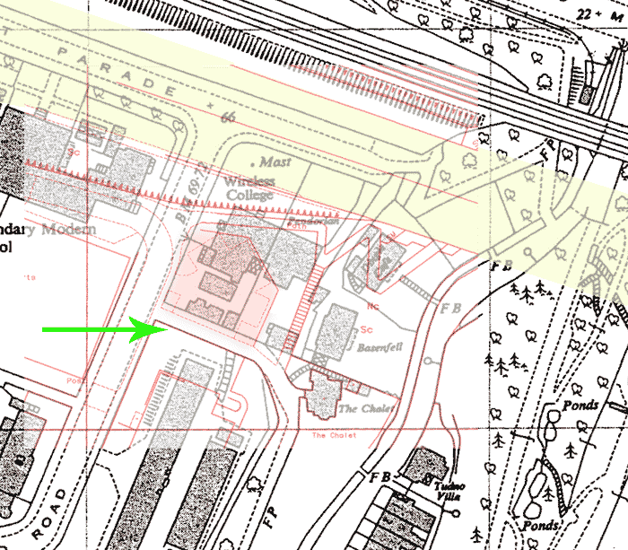
This is a map from 1961 with an overlay in red from a recent one. |
||||||||
 |
||||||||
|
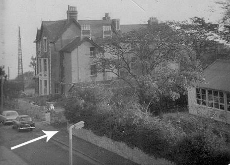
The red lines are the overlay of a section of a current map. The pink shaded area covering part of the college site is a car park, the dotted lines within show the car parking area. The green arrow indicates the wall of the back lane - shown on both maps. The wall, and a slightly narrower lane, are still there. The wall is in line with the arrow in the photo below. The yellowish shading is the A55 expressway (continued beyond the edge of the overlay) - the mast would now be in the middle of the west-bound carriageway. The Dingle Cafe has gone and the site is beneath the new path down to the promenade. The house south of the Cafe has also gone but “The Chalet” is still there. For a wider version of the above map click here For a closer view of the WC click here For a version of the above where the overlay can be removed and replaced, click here (this might not work on your computer) |
||||||||
 |
||||||||
|
|
||||||||